Advantages of Drone Inspections For Commercial Property Management
We help Property Managers find new ways of saving time, money, and increasing safety. Property Managers are often unaware of the new and better methods available to them through the use of drones. Instead of paying extra to respond to issues as they occur, use your continuously updated inspection reports to create and execute a proactive plan.
DRONE INSPECTIONS
CONNOR offers drone inspection services across a wide range of industries and applications.
Accurate, actionable, safe, and fast. Find out how Drone Roof Inspections help you reduce costs.

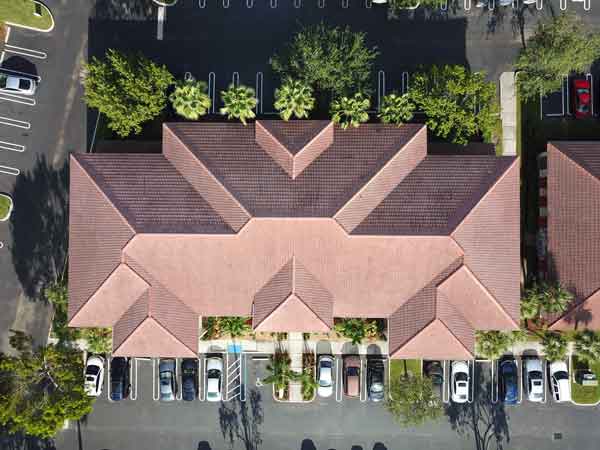
Property Inspections
Our UAV property inspections provide imagery and 3D mapping for buildings, work sites, multifamily housing, and more
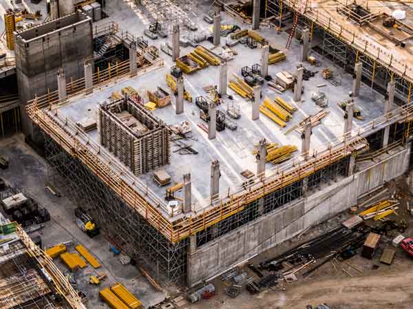
Construction
Construction drone inspections that help you track progress, create 3D maps, and manage your work site.

Oil and Gas
Oil and gas drone inspection services provide valuable, actionable data.

Wind and Solar
Drone inspections of solar panels and wind turbines.

Utility Inspections
Drone inspections for Utility, Infrastructure, and Telecom applications.
DRONE INSPECTION BENEFITS
Real Time Visibility: Travel costs and time on site can be reduced, making UAVs an incredibly valuable asset.
Insurance for Storm Damage: Flooding, fires, earthquakes, hurricanes all provide opportunities obtain data in real time for both homeowners and insurance companies alike.
Aerial Surveying: With a mapping UAV, the turnaround time to have data returned is less than 24 hours at a much lower cost than traditional methods.
Travel Budget: With a data collection drone, companies can provide continuous progress updates to clients without the additional budget and time costs.
Manned Surveys and Insurance: A mapping drone can map a 100-acre job site in 20 minutes. It takes a manned survey team one to two months to accomplish the same task.
Precision: Drones are excellent for taking high-quality aerial photographs and video and collecting vast amounts of imaging data. These high-resolution images can be used to create 3-D maps and interactive 3-D models, which have many beneficial uses.
Energy and Gas: Drones can ensure plants and pipelines are in compliance with regulations and ensure efficiency in operations – saving countless dollars in a single flight.

